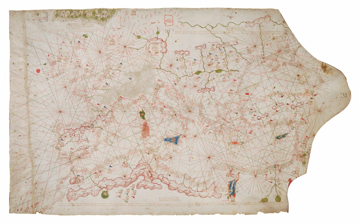
The intriguing aspect of history and its evidence lies in the fact that one never knows when it will resurface in the present. Whoever claimed that “the past is in the past” did not realize that this axiom doesn’t apply to maps and artifacts from bygone eras. A piece of history has reemerged in the form of a map that depicts the waterways of the Mediterranean and beyond.
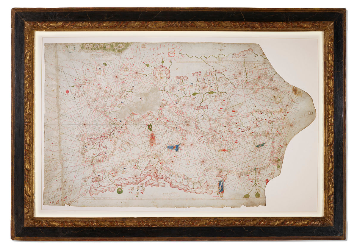
The Ann and Gordon Getty Collection’s auction at Christie’s last year was a resounding success, except for one significant oversight – they greatly underestimated the value of a vellum nautical map, known as a portolan chart. According to the auction house’s so-called “expert” opinion, this peculiar map belonged to the early 16th century and could fetch between $100,000 to $150,000 at the 2022 auction. However, Alex Clausen, a map dealer from San Diego, recognized that it was far more special than Christie’s had acknowledged. Not only was the price estimate too low, but the suggested timeline of 1500 to 1525 was off by not just decades but centuries.
Clausen seized this opportunity, and when the auction took place in October, he and his team at the map dealership, Barry Lawrence Ruderman, successfully acquired this once-in-a-lifetime discovery for $239,000. The most exciting part is yet to come: Clausen revealed that the map, featuring a crescent flag over southeastern Spain, suggests the existence of a Moorish kingdom that persisted until 1492. The intricate borders of mainland Europe indicate a time preceding the conclusion of the Hundred Years’ War. According to Clausen, the chart had been crafted in the early 1400s. After consultations with scholars and catalogers, it was confirmed that the nautical map actually dated back to the mid-1350s. To substantiate his claim, the dealer sent his possession to a New York laboratory for pigment analysis and carbon dating, which conclusively proved that the chart had been created sometime between the 1320s and 1420s.
Barry Lawrence Ruderman eventually settled on the year 1360 and rechristened their chart as the Rex Tholomeus Portolan Chart, in homage to the geographer Ptolemy, who appears in the bottom right corner of the map. The Tholomeus Portolan Chart has now become the fourth oldest surviving portolan chart of Europe, and its estimated worth has skyrocketed to $7.5 million.
“We have engaged in conversations with numerous experts in niche subject areas regarding how this chart impacts their work,” Clausen stated to Artnet. “I’m particularly interested in hearing from individuals outside the map world to gain their insights.”