
What if satellites could spot a wildfire when it was still little more than a patch of heat on the ground, long before it became a disaster visible from space? That is the idea behind FireSat, a new satellite network backed by a $26 million investment from Jeff Bezos through the Bezos Earth Fund and built specifically to detect and monitor fires. The first images from its three operational satellites were recently released by Earth Fire Alliance and Muon Space, offering a revealing glimpse of what the system can already see from orbit. Rather than simply producing conventional satellite photographs, FireSat combines multiple infrared channels to identify heat, measure fire intensity, and track how a fire develops.
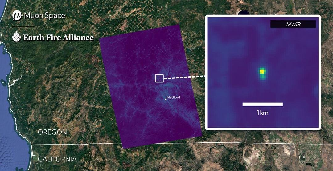
The newly released images are not FireSat’s first ever, because a prototype satellite launched in March 2025 had already collected more than one million images and detected a small roadside fire in Oregon that other satellites missed. The latest imagery instead marks the transition from that experimental mission to the first three satellites of an operational constellation.

Those satellites reached orbit on July 7 aboard SpaceX’s Transporter-17 rideshare mission and began returning imagery approximately three weeks later. Their first observations span Australia, Portugal and the United States, ranging from small managed burns to a massive wildfire that had already consumed roughly 290,000 acres.

FireSat sees fires that conventional satellites can miss
The first operational FireSat image shows Dubbo in New South Wales, Australia, with several different views revealing how the satellite interprets the landscape. Its shortwave, near-infrared and red channels distinguish vegetation, farmland, bare ground, urban areas and water, while the infrared channels reveal differences in surface temperature. During the same pass, FireSat detected several small and relatively cool fires scattered across surrounding farmland, which were associated with agricultural, hazard-reduction, or cultural burning.

That ability to identify relatively small heat sources is particularly important because FireSat’s midwave infrared instruments can detect fires measuring approximately 5 x 5 meters, roughly the footprint of two parking spaces. The system does not produce a five-meter-resolution photograph of such a fire, but instead detects the infrared energy from a small fire within a much larger image pixel.
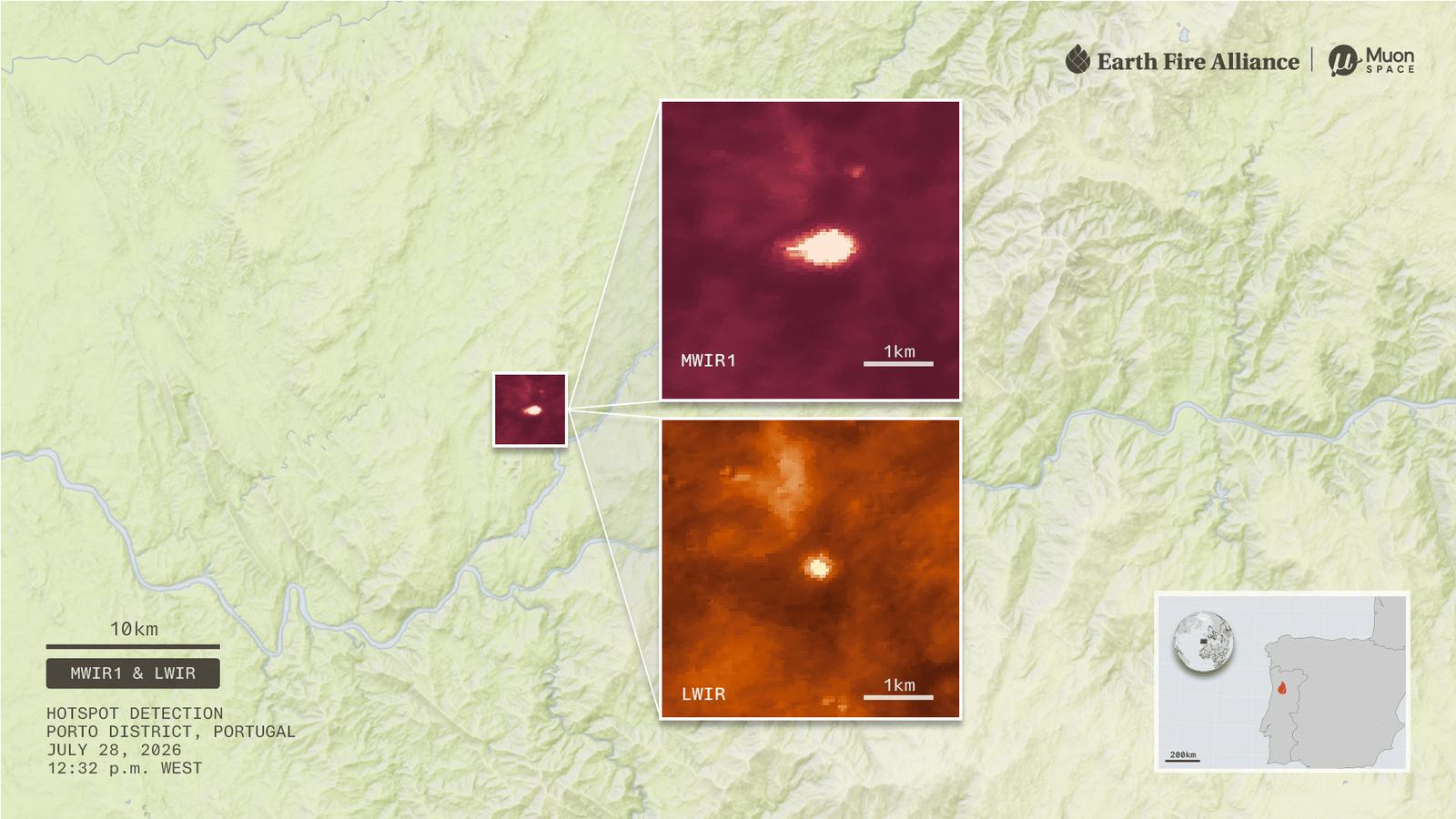
The next day, FireSat detected a single hotspot in Portugal’s Porto District, where EFA’s partners confirmed that it represented the final stages of a small regional wildfire. The observation illustrates another potentially valuable capability because satellites can continue identifying residual heat after visible flames have diminished. FireSat’s infrared channels can help locate smoldering vegetation, hotspots inside an established fire perimeter, and possible reignitions.

The system can also combine its midwave and longwave infrared measurements to calculate fire radiative power, providing an indication of how intensely a fire is burning. Portugal’s Agency for Integrated Rural Fire Management is among the early adopters preparing to evaluate information such as fire alerts, perimeters, radiative power and rates of spread.

The satellites are designed to watch a fire evolve
The most dramatic images came from the Big Grass Fire along the Oregon-Idaho border in the United States. When FireSat observed it, the blaze had already burned about 290,000 acres, roughly the size of Los Angeles, across grass, rangeland, heavy sagebrush, and scattered timber. FireSat captured five views over three nights and two days, showing the active front scattered across a broad area before activity concentrated along the Owyhee River and subsequently weakened.

Its different infrared channels revealed where the fire was hottest, where smaller or cooler areas remained active, and where smoldering activity persisted. The imagery demonstrates why the system is intended to provide more than a simple yes-or-no indication that a wildfire exists.

Each FireSat satellite carries a six-channel multispectral infrared instrument, including a highly sensitive midwave channel designed to detect small fires through smoke and a less sensitive midwave channel designed to preserve detail in extremely hot sections without becoming saturated. Longwave infrared adds temperature information that can reveal smoldering areas while helping distinguish fires from other heat sources such as warm soil or reflected sunlight.

Google’s artificial intelligence is also being used to compare new observations with previous imagery and contextual information to help separate genuine fires from potential false positives. FireSat was developed after consultations with more than 200 firefighters, incident commanders and scientists, with the broader goal of giving emergency agencies more time to determine where a fire is moving and how aggressively it is developing.
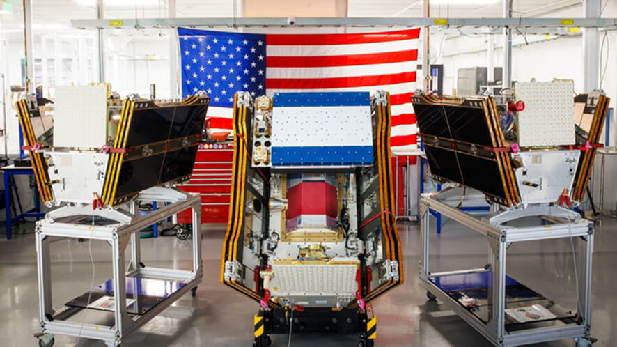
By 2029, FireSat’s planned constellation of more than 20 satellites is expected to deliver hourly global revisits. At that coverage rate, it is projected to reduce the amount of U.S. land burned annually by 1.3 million acres, nearly seven times New York City’s land area, protect 3,500 homes and properties, and prevent 21.9 million tons of carbon emissions.

The longer-term ambition is even more aggressive, with around 50 satellites planned for the early 2030s to provide updates every 20 minutes or less. For the Bezos Earth Fund, the $26 million investment is therefore backing something considerably larger than three satellites, with FireSat intended to become a global wildfire intelligence network that can detect fires earlier, follow their progression, and give the people fighting them more time to act.